
South Africa is the largest producer of carbon dioxide on the African continent, and as such has committed itself to ambitious emission reduction plans, aiming to cut production of the gas by 40% by 2050. At the same time the country is still attempting to expand electricity production rapidly, in order to provide energy to sections of the population which were denied it during the apartheid period. To this end it has recently commissioned the building of two new large-scale coal-fired power stations, which will double the countries energy production, but also sharply increase its emissions of carbon dioxide. In order to reduce emissions in the longer term, South Africa is planning the expansion of its solar, wind, hydroelectric and biofuel sectors, as well as the introduction of a carbon-tax (which opponents claim will undermine the country’s economy).
One option that has received little consideration in South Africa is geothermal energy, largely due to the presence of the Kaapvaal Craton beneath much of the country. This is an ancient, thermally inert, section of continental lithosphere which extends as much as 250-300 km beneath the surface, effectively acting as a thermal insulator and preventing heat from the Earth’s interior reaching the surface. However, while the keel of the Kaapvaal Craton prevents geothermal energy reaching the surface above it, it also tends to deflect rising heat into the lithosphere on either side of it,with the effect that these areas do have the potential for geothermal energy generation.
In a paper published in the South African Journal of Science on 27 March 2014, Taufeeq Dhansay of the Council for Geoscience in Polokwane and the Africa Earth Observatory Network at Nelson Mandela Metropolitan University in Port Elizabeth, Maarten de Wit, also of the African Earth Observatory Network at Nelson Mandela Metropolitan University and Anthony Patt of the International Institute for Applied Systems Analysis in Laxenburg, Austria and ETH University in Zürich, Switzerland, discuss the possibility for a geothermal energy plant near Makuleni Village in Limpopo Province, South Africa.

Geothermal potential map produced using available heat flow data created using inverse distance weighting within Quantum GIS. Major tectonic boundaries and geological features are highlighted. Dhansay et al. (2014).
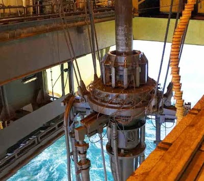
Dhansay et al. look at a possible Enhanced Geothermal Systems plant, a system which exploits latent heat in deeply buried crustal rocks, unlike the systems build around hydrothermal or volcanic sites, which exploit heat direct from the Earth’s convective mantle. Such a plant would pump a water-based ‘working-fluid’ into a deep geothermal reservoir, using the heat of the rocks to raise the temperature of this fluid, which is then pumped back to the surface where it is passed through a heat exchange system transferring heat to a second (organic based) fluid with a lower boiling point. This second fluid flashes to steam, driving the turbines which produce electricity.

Schematic illustration of the hypothetical enhanced geothermal system plant in the Limpopo Province. The blue line indicates the influx well and the red line indicates the outflow/production wells. Also shown is the depth, geological profile, geothermal gradient and detailed binary production system. Dhansay et al. (2014).
In order to work efficiently such a project needs access to buried crustal rocks with a high content of decaying radioactive elements, thick enough to have a homologous mineral composition; typically a granite batholith (a volume of mantle derived magma in the lithosphere, which is slowly cooling allowing the formation of large mineral grains). Makuleni is located about 20 km north of the Kaapvaal Craton, on the boundary between the central and southern marginal belts of the Limpopo Belt. The surface rocks are from the 1.85 billion-year-old Soutpansberg Group, which comprises volcanic and sedimentary formations. The area has hot springs, producing water at the surface as warm as 70˚C, and the temperature is thought to be in the 100-200˚C range 2-3 km beneath the surface.

Overview of the Siloam Valley and Makuleni Village: the site of the hypothetical enhanced geothermal system. Dhansay et al. (2014).
Dhansay et al. calculate that an Enhanced Geothermal Systems plant located at Makuleni would have the potential to produce energy at a cost of 14US¢/KWh (fourteen US cents per kilowatt hour), somewhat more expensive than the current 714US¢/KWh achieved by coal in South Africa, but comparable with other forms of renewable energy. However it is likely that the introduction of a carbon tax in South Africa will substantially raise the cost of coal-fired generation, making such projects more economically viable within the foreseeable future.
See also…

A number of workers are reported to have been treated for minor injuries following an incident at the Rio Tinto operated Rössing...

The Friends of the Earth-affiliated environmental group Justica Ambiental has taken up the case of villagers living close to an open-pit coal mine operated by Indian company Jindal Steel in Tete Province in western Mozambique. Villagers in the Chirodzi (Cahora Bassa), Chirodzi (Changara), Cassoca and Nyantsanga communities have complained of a permanent cloud coal dust...
Nigeria is the world's fifth largest oil producer, earning over 98% of its export earnings from the sale of hydrocarbons. However the presence of oil has widely been seen as a curse as much as a blessing, with the oil producing areas of the Niger Delta having...
Follow Sciency Thoughts on Facebook.