
The United States Geological Survey detected a Magnitude 4.3 Earthquake at a depth of 10 km close to the northern shore of the Gulf of Corinth, slightly before 6.05 am local time (slightly before 3.05 am GMT) on Saturday 10 May 2014. People have reported feeling shaking up to 30 km from the epicenter of this event, but there are no reports of any damage or casualties.
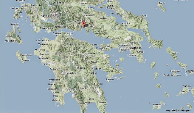
The approximate location of the 10 May 2014 Gulf of Corinth Earthquake. Google Maps.
The geology beneath the Gulf of Corinth is slightly complicated. The Gulf forms part of the boundary between the Aegean and Eurasian Plates. This is a divergent margin, with the two plates moving apart, causing sinking in the centre of the Gulf, with the rocks on either side sinking along a series of faults, a structure known as a graben to geologists.
However this is not the whole story, as to the south of The Peloponnese the African Plate is being subducted beneath the Aegean Plate along the Hellenic Subduction Zone, passing under The Peloponnese and the Gulf of Corinth (note this is oceanic plate attached to the north of Africa, not the continental African Plate).
Thus there are two potential causes of Earthquakes beneath the Gulf of Corinth; shallow faulting associated with the graben caused by the drawing apart of the Aegean and Eurasian Plates, and a deeper zone where friction between the subducting African Plate and the overlying Aegean and Eurasian Plates can lead to quakes. However depth is not the only guide to the cause of a quake, as the friction of the African Plate passing under the Aegean and Eurasian Plates also exerts stresses on the rocks in the graben, and can contribute to quakes there.
See also...

The United States Geological Survey recorded a Magnitude 4.5...

On Saturday 22 September 2012, slightly after 6.50 am local time (slightly after 3.50 am, GMT) a Magnitude 5.1 Earthquake hit central Greece, slightly to the north of the Gulf of Corinth and roughly 100 km northwest of Athens, at a depth of about 10 km, according to the United States Geological Survey. This is a fairly large quake, and quite shallow, with the potential to cause serious damage to...

At roughly 5.35 pm local time on Sunday 7 August 2011 an earthquake with a magnitude of 5.0 on the Richter Scale occurred beneath the Gulf of Corinth in Greece. Reports on the depth of this quake vary, with the United States Geological Survey giving a depth of 13.1 km and the Centre...
Follow Sciency Thoughts on Facebook.